Monday, October 30, 2023

25 historic images of Route 66 in its early days

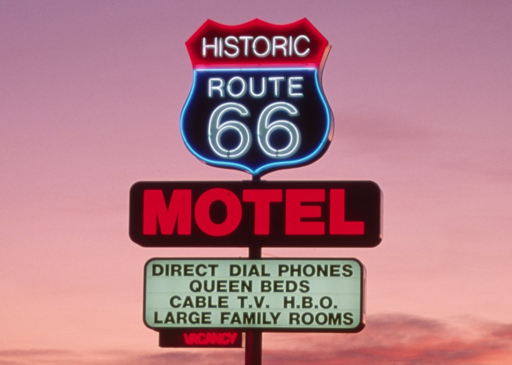
“Historic Route 66” Motel sign at dusk.
Nik Wheeler // Corbis via Getty Images
Read the original, including images:

25 historic images of Route 66 in its early days

With cars rapidly gaining popularity in the early 20th century, an American businessman in Tulsa, Oklahoma, had a vision of a network of highways connecting the whole country.

Starting small in 1901 as a businessman and county commissioner, Cyrus Avery was nominated in 1925 to the newly formed Joint Board on Interstate Highways, a federal agency tasked with coordinating, organizing, and numbering the country's road system.

Officially commissioned on Nov. 11, 1926, and first marked with roadside signs in 1927, Route 66—officially U.S. Highway 66—connected Chicago and Los Angeles, not coincidentally passing through Avery's adopted hometown of Tulsa, Oklahoma. Just 800 of its 2,500 miles were paved in the new route's first year.

Ahead of Route 66's 97th birthday, Stacker curated a slideshow highlighting the construction and early years of the iconic American road.

In Tulsa, highway supporters—including Avery—in 1927 formed the U.S. 66 Highway Association, an advocacy group to promote the new highway to drivers and tourists, as well as to policymakers who could approve funds for paving. The highway became nationally famous and earned the moniker "the Main Street of America."

A major boost to the road's popularity came from John Steinbeck's 1939 book "The Grapes of Wrath," in which the author nicknamed Route 66 "the Mother Road" and chronicled the fictional Joad family's trip along the highway from Dust Bowl Oklahoma to the fruit fields of California. In the economic boom following the Great Depression and World War II, families—lured by history, popular culture, and countless tourist attractions—piled into their vehicles and set out to explore Route 66.

The Interstate Highway Act of 1956 heralded the road's decline, as the smaller U.S. routes were supplanted by massive, multilane interstates. But nostalgia kept the myth alive and even resulted in a resurgence of attention. Much of the original Route 66 received a National Scenic Byway designation, with many stretches featuring tourist attractions, lodging, and food aimed at road-trippers exploring one of America's most iconic roads.

Keep reading to discover more history of the iconic Route 66.

Chicago's bronze lions

Historic Illinois transportation maps show that one end of Route 66 abutted the Michigan Avenue entrance of the Art Institute of Chicago. At the stairs leading up to the institute, a massive pair of bronze lions stare out. Sculpted by 19th-century American artist Edward Kemeys, they mark the historic start of the Mother Road.

Facing another day of the 'Bunion Derby'

In early 1928, in part as a publicity stunt to promote the new highway, Illinois businessman and promoter Charles C. Pyle announced a coast-to-coast footrace from Los Angeles to New York City running the length of Route 66 before shifting to other highways to get farther east. Nicknamed the "Bunion Derby" for the damage it was expected to cause its contestants' feet, the race began on March 4, 1928, and finished on May 26. It was won by Andy Payne of Claremore, Oklahoma, after 573 hours, 4 minutes, and 34 seconds of running, wearing through five pairs of running shoes over more than 3,400 miles.

A Santa Fe street scene

The La Fonda Hotel in Santa Fe, New Mexico, is on the city's central plaza and claims to occupy the site of a hotel dating back to 1607. A luxurious hotel when its current building was built in 1922, generations of Route 66 travelers passed by with some almost certainly staying the night.

'Okies' arrive in California

Traveling "the Mother Road" like the Joads in Steinbeck's novel, Depression- and Dust Bowl-era refugees from Oklahoma sought new opportunities in California. This famous image by iconic photographer Dorothea Lange is described in its Library of Congress record as "Depression refugee family from Tulsa, Oklahoma. Arrived in California June 1936. Mother and three half-grown children; no father."

The original western terminus

When Route 66 was first opened, its western end was at Seventh and Broadway in the heart of downtown Los Angeles. By 1947, when this image was taken, the route had been extended about 15 miles west to central Santa Monica. An unofficial "End of the Trail" marker was erected in 2009 on the Santa Monica Pier.

Outdoor basket-weaving

Route 66 connected many sections of rural America. Especially in the early days of the highway, travelers regularly passed by scenes of everyday life, like these basket-makers weaving white oak strips near Rolla, Missouri, in 1940.

First stop west of Texas

Seen here in 1956, downtown Tucumcari, New Mexico, was a key stopping point for travelers leaving West Texas. Today, the town is home to the New Mexico Route 66 Museum and thoroughly embraces its Route 66 heritage with public art and neon signs.

A desert rest stop

Service stations along Route 66 were essential stop points for motorists in need of fuel or food—particularly along western stretches through the desert in states such as Arizona. These businesses, along with others that sprung up to attract passersby, became key elements of the nation's growing car culture.

Overnight in Victorville?

About 100 miles east of the end of Route 66 was Victorville, with a downtown hotel and shops on the corner of D and 7th. That neighborhood is the subject of a yearslong revitalization effort to reclaim some of its former glory.

Maybe don't follow Bugs Bunny?

Halfway from Albuquerque to the Arizona state line is Grants, New Mexico, seen here in September 1950. Drivers who—like Bugs Bunny in several cartoon episodes—missed a tricky left turn in Albuquerque might have needed help getting back on the right road before reaching Grants. Today, the town is home to an art museum with Route 66 memorabilia as well as exhibits of more modern local art.

The wide-open road

Some of America's love affair with cars and the open road might be due to vistas like this one from New Mexico in 1940: No traffic in sight, a clear sky, mountains in the distance, and a lovely smooth strip of pavement just waiting to be driven.

Iceberg in the desert

Mac's Iceberg Cafe and Gas Station, found on East Central Avenue in Albuquerque, was a classic only-in-America, only-on-Route-66 roadside attraction designed to make a spectacle—and a must-stop destination—for tourists. Of course, ice cream and gas were major attractions of their own for weary travelers.

Heading east

During the early 1940s, the war effort brought people from all over the U.S. to California factories and shipyards. After the war, people headed back to where they came from—including the family pictured here, pulling a trailer behind their vehicle on their way from California to Minnesota less than two weeks after Japan surrendered.

Making connections

Finished in 1965, the Gateway Arch in St. Louis reflected the nation's urge for westward expansion. It was visible to anyone driving on Route 66 across the Mississippi River.

A namesake of the highway

Will Rogers, an Oklahoma native, was an early multimedia star known for performances in vaudeville and Broadway shows, movies, and radio spots, and for writing humorous and sharp political commentary in newspaper columns around the country. A member of the Cherokee Nation, he became known as the "Cowboy Philosopher" for his witty insights and clever sayings. The New York and Hollywood star drew attention around the world, which he traveled extensively before being killed in a 1935 plane crash in Alaska. Rogers was memorialized with a statue and museum in Claremore, Oklahoma, along Route 66.

Check out the Gila monster

The Tomahawk Trading Post outside Albuquerque offered many enticements to draw tourists in, including a live Gila monster. It was not nearly as large as the painted sign might have suggested.

A commercial thoroughfare

Though wildly popular with tourists, Route 66 was originally envisioned as a boost to commerce. Trucks like this one photographed in 1968 carried freight all along it for decades until wider, faster interstate highways were built.

Passing through the Duke City

The road was wide and busy as Route 66 travelers drove through Albuquerque in 1969. Gas stations, hotels, and fast food were all eager to attract customers on the Mother Road.

Souvenirs and novelties

The Jack Rabbit Trading Post near Joseph City, Arizona, was one of many roadside attractions along Route 66. It's still there, but sometime since this 1958 photo a different statue of a jackrabbit has been installed out front. Souvenirs like the one the child is wearing here often echoed stereotypes of the time period and highlighted the fact that the road passed through Indigenous lands.

On a corner in Winslow, Arizona

Native Americans found opportunity along Route 66—and still do—with an online tour guide to American Indians and Route 66 produced by the American Indian Alaska Native Tourism Association. In this photo from 1979 in Winslow, Arizona, a roadside stop displays and sells local Native American arts and crafts.

Through a harsh landscape

As Route 66 passes through the Petrified Forest National Park in Arizona, vistas open in front of the windshield and the true expanse of the American West becomes apparent.

The Boss loved it

Just along Route 66 in Amarillo, Texas, is the Cadillac Ranch, where 10 old Cadillacs are partially buried, hoods down, as monuments to car culture—and, as Bruce Springsteen had it in his 1980 song—a metaphor for how what once was valuable often becomes disposable. It's still there drawing tourists today.

Save a horse?

The Cowboy Motel in Amarillo, Texas, seen here in 1977, was one of many roadside lodgings that traded on kitsch and stereotypical Western themes to draw customers.

The Wigwam Village Motel

The Wigwam Village Motel in Holbrook, Arizona, pictured here in 1979, still offers travelers a chance to sleep in structures inspired by traditional Native American teepees—intentionally misnamed "wigwams" by the non-Indigenous architect who designed them. The motel is on the National Register of Historic Places because of its significance to Route 66 heritage.

The end of the road

From the late 1930s, Route 66 officially ended at the corner of Lincoln and Olympic boulevards in Santa Monica. But that wasn't a very dramatic location, so the unofficial end became the entrance to the Santa Monica Pier.

Story editing by Nicole Caldwell. Copy editing by Tim Bruns.

Thursday, July 27, 2023

Giuliani claims the First Amendment lets him lie – 3 essential reads

Rudy Giuliani admits to lying but says the Constitution protects him. AP Photo/Patrick Semansky
Jeff Inglis, The Conversation

In his response to a lawsuit filed by two Georgia election workers who said Rudy Giuliani harmed them by falsely alleging they mishandled ballots in the 2020 presidential election, Giuliani has admitted lying. But he says the women suffered no harm – and claims that his lies are protected by the First Amendment to the U.S. Constitution.

The Conversation U.S. has published several articles by scholars explaining what the First Amendment – which, broadly speaking, protects freedom of speech and the press – does and doesn’t say. That includes how it can and can’t be used to protect speech about political controversies, and whether speech that harms or threatens to harm another person is protected. Here is a selection from among those articles.

A group of people stand nearby while a U.S. flag burns.
It may be upsetting to see – but that’s part of the point of burning a flag, and a key reason it’s protected by the First Amendment. Michael Ciaglo/Getty Images

1. Not all speech is protected

The First Amendment’s protections are not absolute, wrote Lynn Greenky, a communications scholar at Syracuse University.

“When the rights and liberties of others are in serious jeopardy, speakers who provoke others into violence, wrongfully and recklessly injure reputations or incite others to engage in illegal activity may be silenced or punished,” she wrote.

“People whose words cause actual harm to others can be held liable for that damage,” she noted. That’s what the Georgia election workers are claiming in their lawsuit.

Lying about people and bullying them can have consequences despite free-speech protections, Greenky explained: “Right-wing commentator Alex Jones found that out when courts ordered him to pay more than US$1 billion in damages for his statements about, and treatment of, parents of children who were killed in the 2012 Sandy Hook Elementary School shooting in Newtown, Connecticut.”

2. Defaming someone can be costly

Jones is not the only defamation defendant who has found lying costly. Dominion Voting Systems sued Fox News for spreading lies about its voting machines in the wake of the 2020 presidential election. Rather than go to trial, Fox settled for $787 million.

But communication scholar Nicole Kraft at The Ohio State University warned that if the case had gone to trial, proving defamation might have been difficult.

To be considered defamation, information or claims must be presented as fact and disseminated so others read or see it and must identify the person or business and offer the information with a reckless disregard for the truth,” she wrote.

Another key question, she observed, is the amount of damage the statements do. “Defamation happens when someone publishes or publicly broadcasts falsehoods about a person or a corporation in a way that harms their reputation to the point of damage,” she wrote.

In his recent court filing, Giuliani appears to be saying the election workers weren’t harmed by his statements.

But they are claiming they were harmed, including that they received threats and hateful and racist messages from people in the wake of Giuliani’s allegations.

A large, columned white building at the top of a grand, white set of stairs.
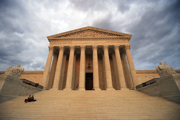
The U.S. Supreme Court has ruled that some false statements are ‘inevitable if there is to be open and vigorous expression of views.’ AP Photo/Manuel Balce Ceneta, File

3. The case could be easier

It’s not clear whether Giuliani has claimed to have been a politician at the time he made the false statements about the Georgia election workers. But he was functioning as a personal attorney and representative of Donald Trump, who is definitely a politician.

Allowing politicians to lie with impunity can be dangerous for democracy, warned Drake University constitutional scholar Miguel Schor:

The First Amendment was written in an era when government censorship was the principal danger to self-government,” he wrote. “Today, politicians and ordinary citizens can harness new information technologies to spread misinformation and deepen polarization. A weakened news media will fail to police those assertions, or a partisan news media will amplify them.”

Schor found a potential solution in a 2012 opinion by Supreme Court Justice Stephen Breyer, which said laws and courts should be able to penalize not just the harms caused by speech but also “false statements about easily verifiable facts.”

Editor’s note: This story is a roundup of articles from The Conversation’s archives.The Conversation

Jeff Inglis, Freelance Editor, The Conversation

This article is republished from The Conversation under a Creative Commons license. Read the original article.

Thursday, July 20, 2023

Black and Latino pedestrians face a higher risk of death while walking

Published in The Emancipator (a joint venture between the Boston Globe and the Boston University Center for Antiracist Research); co-written with Alex LaSalvia


Gallivan Boulevard is a four-lane, arterial road that cuts right through a largely residential community in Boston’s Dorchester neighborhood. At the intersection of Gallivan and Dorchester Avenue, pedestrians heading to school, work, or a neighbor’s house have to cross a slip lane for right turns without a walking signal.

Then they wait up to two minutes on the pedestrian island before crossing four lanes of traffic on a worn-out crosswalk in 25 seconds or less.

“The highway department … wanted to speed everything up. This is a neighborhood, it shouldn’t have speedy roads, it should have things that are going to slow them down a little bit,” said Nancy Thornton, a longtime Dorchester resident who lives at the intersection with Dorchester Avenue.

That intersection was the site of the tragic death of 53-year-old Torrance Hodges, who was struck by a van while crossing the street in April.

“We watched the whole thing from our second floor,” Thornton said. “It was very, very sad.”

It’s not just chance that a road like Gallivan Boulevard runs through one of Boston’s most racially diverse neighborhoods. For decades, highways and roadways were constructed with little regard for increased traffic in Black communities. Sometimes they were intentionally built to divide and isolate those communities.

Across the U.S., Black and Latino pedestrians are more likely than White pedestrians to be struck and killed by cars when walking around their communities.

That’s the conclusion from The Emancipator’s analysis of national and city-level pedestrian fatality data from 2016 through 2020, which compared the locations of those deaths with neighborhood-level race and ethnicity data from the U.S. Census Bureau’s 2020 census. The analysis includes neighborhoods of the five largest U.S. cities — New York, Los Angeles, Chicago, Houston and Phoenix — as well as Boston.

The following maps breakdown racial disparities of pedestrian deaths in those cities. The analysis includes interactive and searchable maps.

">


Overall, there were more pedestrian fatalities in neighborhoods with greater racial and ethnic diversity — and, specifically, communities with lower proportions of White residents. This was true when analyzing data by census tract — a relatively small neighborhood-like area, an area that was usually home to between 2,500 and 8,000 people — or by county, or even by city-defined community regions like the Hollywood Hills in Los Angeles or Boston’s South End.

There were many census tracts that saw no pedestrian fatalities from 2016 through 2020. But they were disproportionately inhabited by White people, 77% of whom lived in a fatality-free census tract.

Black people are 12.1% of the U.S. population, according to 2020 Census estimates, but 19.1% of the pedestrians killed; Latinos are 18.7% of the population and 19.2% of the pedestrian fatalities. By comparison, White people who are not Latino make up 57.8% of the U.S. population but 45% of the pedestrian fatalities from 2016 through 2020.

Asian Americans and people with multiracial backgrounds are less likely to be killed while walking than their prevalence in the nation’s population would suggest.

Even if the large percentage of pedestrian fatalities whose races were unknown or unreported were reclassified according to national proportions, Black and Latino people would still be disproportionately more likely to be killed while walking.


Dangerous roads put pedestrian lives at risk for the comfort of driving

People of color, those with fewer economic resources, and people with mobility limitations – such as those who need wheelchairs, walkers or other help getting around – are all at risk of being killed while walking, said Rebecca Sanders, founder of Safe Streets Research and Consulting and lead author of a study published last year that examines racial disparities and other related factors of pedestrian deaths.

“They don’t like feeling unsafe, but they don’t have another option,” she said.

The racial disparity in U.S. pedestrian deaths doesn’t exist in a vacuum. Cities and towns have been built to give cars priority, Sanders said. Even places touted for prioritizing pedestrians block pedestrian routes with major arterial roads — high-capacity roads that aren’t freeways but often have two lanes in each direction. Many of those arterial roads are state highways that cut through cities at the expense of pedestrian safety, Sanders said.

“If you want to go for a walk to a restaurant or a grocery store, you have to cross a major arterial to get there,” Sanders said.

Those wide roads with fast-moving traffic are where most pedestrian deaths occur, said Mike McGinn, a former mayor of Seattle who is now executive director of America Walks, a pedestrian-advocacy non-profit. Those arterial roads have fewer crosswalks spaced farther apart, and higher speed traffic than smaller, narrower neighborhood roads.

“Guess where those multi-lane arterials are found most often?” he asked. “It’s part of the deeper racial and ethnic inequalities in America.”

Freeways and arterials have long been pushed through Black neighborhoods, particularly during the highway boom of the 1950s and 1960s. Developers built apartment buildings along those roads, putting large numbers of people right in front of heavy, fast-moving traffic, McGinn said.

“Many times these wide arterials have no sidewalks at all. You’ll see a dirt path by the side of the road,” he said. But the dirt path, which emerges from persistent foot traffic, is important evidence: “We know people are there.”

Poles and signs found alongside roads are also indicators of risks of fast-moving traffic. They’re built to reduce the danger to errant drivers. “We design the poles to be breakaway poles because we know cars will leave the roadway and hit them,” McGinn said. “And then we tell people to walk right there.”

“We subsidize the driving comfort of some with the risk of death and injury or health issues for others,” he said.

Structural inequity makes pedestrian danger a race and class issue

Pam Jiner wants to “be able to walk to a practical destination, do what you need and make it back home safely.” But that simple goal is hard to reach.

Jiner is a community leader in Montbello, a neighborhood in the northeast section of Denver, that was built in the mid-1960s. The community had no sidewalks on key roads leading to a major intersection until 2020, Jiner said.

Montbello, home to almost 40,000 people, was once majority Black but is now 77% Latino.

And while Jiner has encouraged everyone in her community to get outside into nature, exercise, and see neighbors, she added, “we get out there and see all the obstacles that are in our way.”

To Jiner, the solutions are so simple it’s sad she has to point them out: “When you build a school, build crosswalks. When you build a park, build stop signs and crosswalks. Senior living facilities all deserve bus stops with shelters, covers over them.”

Instead, she saw roads where “pedestrians are putting themselves in danger” when they attempted to cross or while on sidewalks. Sometimes she would go for walks with local officials, where she would show off a new sidewalk, but they gasped in horror at how dangerous the environment remains for pedestrians. They would tell her, “you have sidewalks but it’s still not safe,” she said.

Jiner drew a parallel to the Black Lives Matter movement, saying public policies that put pedestrians of color at risk are further evidence of systemic racism.

She’s not the only one.

Jonathon Stalls, a self-described “walking artist” who walked across the U.S. over eight and a half months in 2010, and wrote a book about it, agreed. He said he saw what his friend and fellow Denver resident Jiner mentioned — structural racism tied to pedestrian safety —as “a consistent thing across the country.”

In his efforts to encourage people to walk or “move the way we’re made to,” Stalls paid close attention to the cars on the roads he walks along as well as other pedestrians.

He spoke of seeing older adults on their own and parents clenching the hands of young children, navigating multi-lane arterial roads or standing on the three-foot-wide cement platforms dividing the lanes of traffic. “The way that they’re standing and shaking and huddling is really loud to me,” he said. “They’re surrounded by hundreds of cars flying in all directions.”

Stalls said he’s fortunate not to have been hit by a car in all of his walking, but he’s had “a lot of close calls.” And on his nation-crossing walk, he saw roadside memorials to pedestrians killed “all the time.”

Stalls chronicled various walking experiences through PedestrianDignity, his TikTok account. Some of his videos might be comical if they weren’t so scary.

In one video, Stalls narrated his attempt to walk from a bus stop to a grocery store just blocks away. He showcased a beautiful, wide, smooth sidewalk perfect for pedestrians, including people using wheelchairs or walkers. But then he got to the property line, and the sidewalk stopped. A fence ran across the route, forcing him into the road alongside heavy vehicle traffic.

Timing his move carefully, and making clear he does not recommend anyone follow his example, Stalls ran past heavy underbrush and foliage that had overgrown the curb, spending eight seconds in the actual roadway before reaching relative safety: a stretch where the brush had been cleared, revealing a dirt path just inches wide. At least it was beyond the curb.

‘Make noise and get attention’ to spur progress for pedestrians

People aren’t powerless when it comes to pushing for improved conditions for pedestrians.

Guerrilla traffic cone placementroad blockades, and street art are just some of the methods people are using to reclaim the streets in their neighborhoods. Countless pedestrian safety groups have sprung up nationwide — there’s probably one in your neighborhood, and if not, there are resources for you to start one.

Change comes when communities make noise and create “a little bit of inconvenience,” said Ed Parillon, a bike and pedestrian safety advocate and member of Safe Street Rebel in San Francisco. Safe Street Rebel is an advocacy organization focused on direct action such as organizing people to stand in bike lanes to create barriers between cars and cyclists. The group has elevated issues like public transport investment and protected bike lanes.

“We still have a long way to go,” Parillon said, but protected bike lanes weren’t “even part of the conversation when I moved to San Francisco in 2008.”

In San Francisco, the difference in pedestrian safety in Black and Brown neighborhoods versus White affluent neighborhoods can be stark. Parillon lives in the Mission District, which doesn’t have the same walkability as the wealthier, whiter neighborhood of Noe Valley.

“It was really striking when I was walking around with my kids there versus in the Mission,” Parillon said. “You feel the safety on the street, you feel the lower stress levels when you’re walking places.”

Parillon credited spaces like Streetsblog, a news site advocating for the end of car dependence since 2006, for sparking his interest in advocating for safer pedestrian conditions. He recommended getting involved with local organizations focused on street safety.

“If you are someone from a minority community and you want to point out some of the street conditions that are dangerous in your neighborhood, I do think that there’s a lot of focus on that now,” Parillon said. “Get out there and make noise and get attention, because that’s the only way that this stuff makes progress.”


Methodology

The Emancipator analyzed data from New York, Los Angeles, Chicago, Houston, Phoenix and Boston.

Fatal crash locations were compared with city limits, and assigned to census blocks, which were in turn assigned to community subdivisions, as defined by city officials. Three cities — LA, Chicago and Boston — called the community subdivisions “neighborhoods,” but they were called “community districts” in New York, “super neighborhoods” in Houston, and “villages” in Phoenix.

There were 33,375 records in the National Highway Transportation Safety Administration’s database of pedestrian fatalities from 2016 through 2020. Of those, 2,058 — 6% — were injuries and not fatalities. It was not possible to know where deaths occurred based on 167 of the records, 0.5%, because the latitude and longitude information was “unknown,” “not reported” or “not available.” When matched with census tracts, three had no census tract to match to, leaving 31,147 pedestrian fatalities from 2016 through 2020 to analyze.

When calculating pedestrian fatality rates by census tract, some tracts had very low populations, or even zero. So the analysis excluded tracts with fewer than 1,895 people — 5% of the maximum tract population of 37,892.

In the analysis within cities, the potential errors were very small: Phoenix’s share of crashes with unknown or unreported locations, 4.6%, was the highest among the six cities. And small proportions of each city’s reported crashes were non-fatal. Overall, just 9.6% of all the crashes reported in these six cities were excluded from the analysis.

States where the most residents are struggling to find their next meal

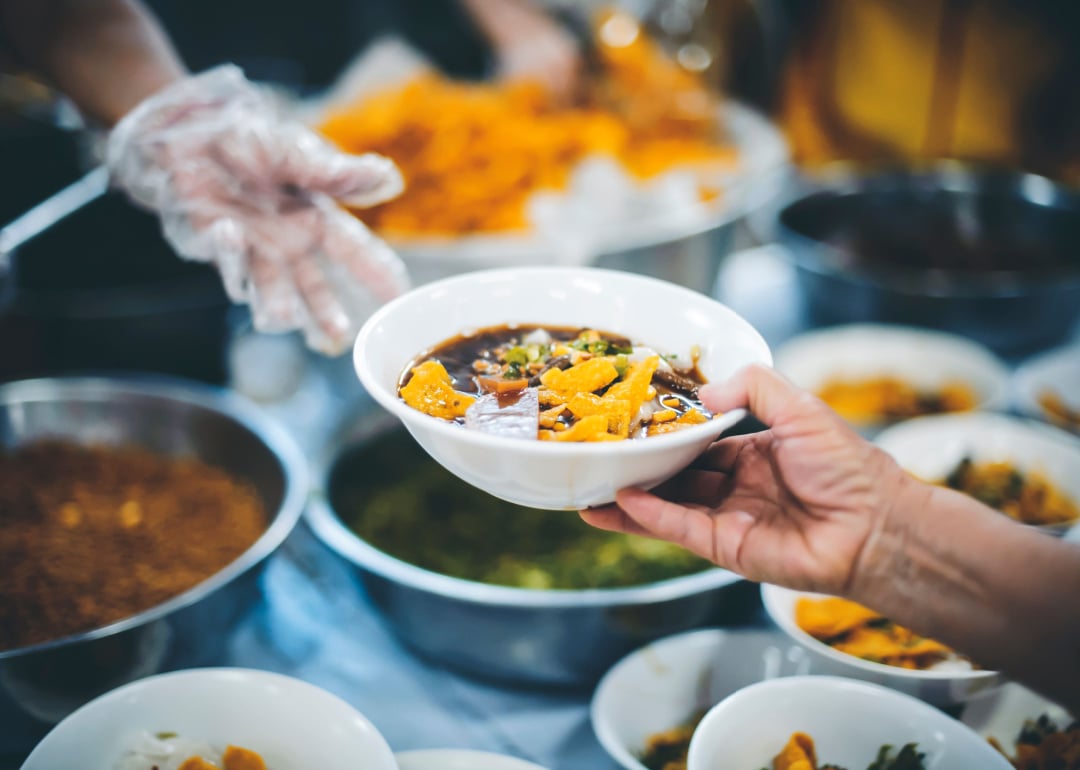
Hands sharing food in a community kitchen.
addkm // Shutterstock

Published in Stacker; co-written with Sarah Dolezal

Nearly 12% of U.S. adults reported being hungry sometimes or often during a Census Bureau survey in June 2023.

The longstanding problem does not affect all Americans equally. A Department of Agriculture study examining data from 2019 and 2020 found that children, single parents, single adults, low-income households, people of color, and households in the South were all more likely to experience food insecurity than the national average.

Overall, the country saw a negligible uptick in hunger from June 2022, with less than 1 additional percentage point of adults reporting their household sometimes or often didn't have enough food.

Stacker analyzed Census Bureau data to rank each state based on how many residents reported going hungry. Population estimates are from the Census Bureau. Percentages represent the portion of the overall adult population that reported to the Census Bureau in mid-June that they lived in a household where there was either sometimes or often not enough food to eat in the last week.

#51. North Dakota

- Percent of adult population hungry: 6.4%
- 1-year change: -2.1 percentage points
- Total adult population: 570,659

The state's only food bank, Great Plains Food Bank, supplies more than 300 food pantries, soup kitchens, and shelters across the state. The state's website also offers several other options for people to get help finding food, including mobile food pantries to deliver food in remote areas, collaborations with farmers, and connections to federal programs.

#50. Maine

- Percent of adult population hungry: 6.9%
- 1-year change: -0.7 percentage points
- Total adult population: 1,113,361

In 2019, lawmakers asked the state's Department of Agriculture, Conservation and Forestry to develop a plan to end hunger by 2030. "Current levels of hunger and food insecurity—as high as 16.4% of the population in recent years—extract an enormous human toll," the department reported. In recent years, the Good Shepherd Food Bank, the state's largest, has raised more than $250 million toward its goal of ending hunger in the state. For the year ending June 30, 2023, the food bank distributed 31.5 million meals statewide.

#49. New Jersey

- Percent of adult population hungry: 8.2%
- 1-year change: -2.2 percentage points
- Total adult population: 7,122,199

The Community FoodBank of New Jersey distributes food to pantries, soup kitchens, and shelters in most of the state's 21 counties. In just one year, it distributed 103 million pounds of food, enough for 86 million meals; one-third was fresh produce. It also helps residents apply for state and federal aid programs.

#48. Vermont

- Percent of adult population hungry: 8.4%
- 1-year change: -0.3 percentage points
- Total adult population: 510,057

The Vermont Foodbank, operating since 1986, supplies more than 150,000 Vermonters annually. Hunger Free Vermont has been working to end hunger in the state since 1993 by supporting and urging the expansion of federal and state programs providing food assistance to hungry people.

#47. Delaware

- Percent of adult population hungry: 8.5%
- 1-year change: -2.5 percentage points
- Total adult population: 802,595

Delaware Health and Social Services lists food banks and food pantries around the state. As federal food-aid programs contract benefits extended during the coronavirus pandemic, the Delaware Food Bank is among the groups seeking additional donations.

#46. Missouri

- Percent of adult population hungry: 8.6%
- 1-year change: -2.5 percentage points
- Total adult population: 4,681,751

The Feeding Missouri network of food banks distributes 120 million pounds of food annually to more than 1 million Missourians. It reaches across the state's 114 counties and St. Louis through more than 1,500 agencies and programs.

#45. Colorado

- Percent of adult population hungry: 8.9%
- 1-year change: 1.5 percentage points
- Total adult population: 4,553,684

Costella and Crowley counties had the highest hunger rates, with 17% of residents categorized as food-insecure in 2020, according to data from the University of Wisconsin Population Health Institute. Douglas and Elbert counties had the lowest food insecurity rates, at 6%. The state's Department of Human Services coordinates government benefits with food-distribution partners across Colorado.

#44. District of Columbia

- Percent of adult population hungry: 9%
- 1-year change: -1.3 percentage points
- Total adult population: 514,777

Across the District, churches, nonprofit agencies, and government offices offer free food, money to buy food, and other support to hungry D.C. residents.

#43. New Hampshire

- Percent of adult population hungry: 9.2%
- 1-year change: 1.9 percentage points
- Total adult population: 1,117,829

NH Hunger Solutions is a nonprofit that touts its effectiveness in supporting government programs to fight hunger and encouraging eligible Granite State residents to seek help getting enough food. The state's Department of Health and Human Services has specific programs for families with children and senior citizens who don't have enough food.

#42. Utah

- Percent of adult population hungry: 9.2%
- 1-year change: 1.5 percentage points
- Total adult population: 2,450,650

A new state commission will keep the public and lawmakers informed about how to help food-insecure Utahns. The Utah Food Bank keeps track of food pantries across the state and offers an interactive map to help people find the most convenient one.

#41. Washington

- Percent of adult population hungry: 9.2%
- 1-year change: 0.2 percentage points
- Total adult population: 6,050,305

About 13% of Seattle adults are food-insecure, according to a 2019 government report. In 2019, 1.1 million Washingtonians at risk of going hungry received 148 million pounds of food through food banks, pantries, and other programs across the state.

#40. Minnesota

- Percent of adult population hungry: 9.3%
- 1-year change: 2.1 percentage points
- Total adult population: 4,311,532

In 2022, the Food Group, a Minnesota-based nonprofit, provided more than 6 million meals to hungry people in Minnesota and Wisconsin, which the agency also serves. Another agency, Hunger Solutions, tracked 5.5 million visits to food shelves across the North Star State in 2022.

#39. Oregon

- Percent of adult population hungry: 9.3%
- 1-year change: 1.7 percentage points
- Total adult population: 3,315,259

A 2022 Ford Family Foundation analysis found that Grant and Lake counties have the most food insecurity, while Washington and Hood River counties have the least. The Oregon Food Bank maintains a list and an interactive map of more than 600 places Oregonians can get free groceries and produce or free meals.

#38. Massachusetts

- Percent of adult population hungry: 9.6%
- 1-year change: 0.2 percentage points
- Total adult population: 5,427,691

A nonprofit called Project Bread has a phone hotline anyone can call to get help finding food immediately and over the long term. Several food banks around the state help keep local food pantries stocked.

#37. Rhode Island

- Percent of adult population hungry: 9.6%
- 1-year change: -5.1 percentage points
- Total adult population: 848,183

The state government's Rhode to End Hunger Initiative helps coordinate food donations—from people and businesses, including restaurants and markets—and maintains an interactive map of locations where Ocean Staters can get food when needed.

#36. Illinois

- Percent of adult population hungry: 9.9%
- 1-year change: 1.8 percentage points
- Total adult population: 9,564,566

A state commission to end hunger seeks to unite officials, volunteers, business leaders, and others to fight hunger across Illinois. The state also maintains a list of food banks, pantries, and other places hungry people can get help and food.

#35. Idaho

- Percent of adult population hungry: 10%
- 1-year change: -0.8 percentage points
- Total adult population: 1,463,645

The Idaho Food Bank reports that Shoshone County has the highest food insecurity rate in the state, at 14.1% of residents, while Teton County has the lowest rate, at 5.4%. The group also provides an interactive map for people to find food help near them.

#34. Nebraska

- Percent of adult population hungry: 10.2%
- 1-year change: -1.5 percentage points
- Total adult population: 1,455,973

Efforts to fight hunger in Nebraska include two food banks, a mobile food pantry, and dozens of locations to get free food or full meals.

#33. Michigan

- Percent of adult population hungry: 10.7%
- 1-year change: 0.8 percentage points
- Total adult population: 7,735,119

Michigan State University received a $500,000 grant to address hunger in Michigan's Black and Indigenous communities and other underserved communities. The state government is also working on the problem, and a July 2023 law change expanded eligibility for support. Seven food banks in the state supply more than 3,000 agencies that provide food to those in need.

#32. Pennsylvania

- Percent of adult population hungry: 10.7%
- 1-year change: 2.2 percentage points
- Total adult population: 9,933,427

The state government wants to reach everyone in Pennsylvania eligible for federal food-aid benefits and reports reducing the food insecurity rate across the state by 5 percentage points between 2015 and 2022. The state's Department of Agriculture maintains a list of food banks and other food sources for Pennsylvanians in need.

#31. Virginia

- Percent of adult population hungry: 10.7%
- 1-year change: 1.0 percentage points
- Total adult population: 6,631,493

The state's seven food banks helped 1,800 agencies and distribution sites provide 135 million pounds of food to 800,000 Virginians in 2022. An interactive map lets people in need know where to turn for help with food.

#30. Connecticut

- Percent of adult population hungry: 10.8%
- 1-year change: 4.1 percentage points
- Total adult population: 2,789,532

Connecticut Foodshare, the state's largest food bank, provided nearly 39 million meals to residents in need in 2022. The agency partners with 650 food pantries, kitchens, and mobile delivery services to reach every corner of the Nutmeg State.

#29. New York

- Percent of adult population hungry: 10.8%
- 1-year change: 0.1 percentage points
- Total adult population: 15,036,419

The Nourish New York initiative started during the COVID-19 pandemic but has continued to connect New Yorkers with food assistance and make plans for expanding aid and reducing demand. Eight regional food banks help supply millions of pounds of food to those in need.

#28. Wyoming

- Percent of adult population hungry: 10.9%
- 1-year change: -0.5 percentage points
- Total adult population: 442,798

The state's first lady, Jennie Gordon, spearheads a statewide effort to fight hunger. The Food Bank of Wyoming has 160 partner agencies that serve people across all 23 of the state's counties and works to reduce food waste by collecting usable food and distributing it to those in need.

#27. Arizona

- Percent of adult population hungry: 11%
- 1-year change: 0.2 percentage points
- Total adult population: 5,723,779

An AmeriCorps grant will fund 33 volunteers at Arizona food banks to help collect and distribute food for those in need. The Arizona Food Bank Network brings together five food banks and 1,000 agencies to feed 450,000 hungry Arizonans each month.

#26. Wisconsin

- Percent of adult population hungry: 11.1%
- 1-year change: 2.4 percentage points
- Total adult population: 4,538,089

Through Feeding Wisconsin, the state association of six food banks, 750 social service agencies, and 1,500 feeding programs statewide feed almost 600,000 residents yearly. It diverts 16 million pounds of excess food from stores and restaurants and another 3 million pounds of agricultural surplus, helping feed people rather than contributing to food waste.

#25. Tennessee

- Percent of adult population hungry: 11.2%
- 1-year change: -3.4 percentage points
- Total adult population: 5,455,071

The state has five food banks, but hunger remains a problem. A recent state grant program received applications for over $13 million in hunger-fighting funding, but only has $10 million to give out.

#24. North Carolina

- Percent of adult population hungry: 11.3%
- 1-year change: 0.7 percentage points
- Total adult population: 8,270,414

A network of 10 food banks serves both North and South Carolina. Just one of those, the Food Bank of Central and Eastern North Carolina, provides more than 81 million meals annually to hungry North Carolinians.

#23. Hawaii

- Percent of adult population hungry: 11.6%
- 1-year change: 2.8 percentage points
- Total adult population: 1,104,070

The largest food-relief organization in the 50th state, the Hawai'i Foodbank, distributed 17.4 million pounds of food in 2022 to hungry people on O'ahu and Kaua'i. The Maui Food Bank gives out another 3.25 million pounds a year. The Food Basket coordinates hunger relief efforts on the state's largest island and helps 50,000 people each month.

#22. Florida

- Percent of adult population hungry: 11.8%
- 1-year change: 0.9 percentage points
- Total adult population: 17,896,443

Florida's Department of Agriculture works with farmers and schools statewide to collect and distribute edible, healthy food that would otherwise go to waste. Around the Sunshine State, nine food banks and more than 2,400 community groups and agencies distribute over 400 million pounds of food to hungry Floridians.

#21. Iowa

- Percent of adult population hungry: 11.9%
- 1-year change: 1.6 percentage points
- Total adult population: 2,391,994

The Iowa Food Bank Association distributed 45 million meals to Iowans in 2021 through six food banks and 1,200 partner organizations. The state government has also contributed $5 million to expand the capacity of food banks in Iowa.

#20. Montana

- Percent of adult population hungry: 11.9%
- 1-year change: 3.7 percentage points
- Total adult population: 880,407

The Montana Food Bank Network distributed 16 million pounds of food to hungry Montanans in 2022. The state also sells a special-interest license plate to raise money to end hunger in Montana.

#19. California

- Percent of adult population hungry: 12%
- 1-year change: -0.6 percentage points
- Total adult population: 29,670,532

In 2021, California food banks distributed more than 1 billion pounds of food, the equivalent of 850 million meals, and with the help of more than 6,000 food pantries, kitchens, and other distribution groups, provided food to 4.5 million people each month on average. State government efforts include partnerships with farmers and ranchers to use what they might not be able to sell in the marketplace.

#18. Alabama

- Percent of adult population hungry: 12.1%
- 1-year change: -4.8 percentage points
- Total adult population: 3,852,301

Eight food banks cover the state, and the Alabama Public Health website highlights not only traditional food pantries but also "little free pantries," a grassroots network of neighbors who make food available to those in need.

#17. Maryland

- Percent of adult population hungry: 12.5%
- 1-year change: 1.4 percentage points
- Total adult population: 4,704,806

The Maryland Food Bank distributed over 40 million meals in 2022 and has an online map that helps people find food where needed. It also operates several mobile food markets that bring healthy food options to people who cannot travel to stores that offer better food options.

#16. West Virginia

- Percent of adult population hungry: 12.5%
- 1-year change: -8.8 percentage points
- Total adult population: 1,370,064

The Mountaineer Food Bank maintains an interactive map of locations people in need can get food across West Virginia. With programs targeting children, veterans, and those in rural areas, the agency provides 17 million meals a year to hungry West Virginians.

#15. Nevada

- Percent of adult population hungry: 12.6%
- 1-year change: 1.6 percentage points
- Total adult population: 2,494,294

The Silver State has two food banks, one serving the northern two-thirds of the state and the other serving four counties in the southern part. Both have interactive maps to direct people to aid near them.

#14. South Carolina

- Percent of adult population hungry: 12.6%
- 1-year change: -2.6 percentage points
- Total adult population: 4,116,940

A network of 10 food banks serves both North and South Carolina. Harvest Hope Food Bank, covering 20 counties in northern South Carolina, provides 20 million meals annually. The Lowcountry Food Bank, covering another 10 counties in the southeastern part, distributed 39.7 million pounds of food in 2021. Food banks based in North Carolina and Georgia serve the state's 16 other counties.

#13. New Mexico

- Percent of adult population hungry: 12.8%
- 1-year change: -2.5 percentage points
- Total adult population: 1,622,106

Low income is a major cause of food insecurity in Santa Fe and across the state, according to a 2023 Source New Mexico news report. The state's five food banks also work with New Mexico farmers to buy and provide food for those in need. People can view an interactive map to see which food bank, and which of its partners, is nearest. The state also offers money to help college students afford food.

#12. South Dakota

- Percent of adult population hungry: 12.8%
- 1-year change: -0.6 percentage points
- Total adult population: 675,019

Feeding South Dakota provided 15.5 million meals to people across the state in 2022. That included 12.9 million pounds of food, over 3,400 backpacks for children to take home for weekends and school holidays, more than 1,800 boxes to senior citizens, and over 10,000 families served at mobile food pantries.

#11. Indiana

- Percent of adult population hungry: 13%
- 1-year change: 1.8 percentage points
- Total adult population: 5,124,472

Across Indiana, 11 food banks help feed hungry people in the state. They partner with pork farmers, deer hunters, vegetable farmers, and corporate donors to collect and distribute food to those in need. An interactive map directs people to help near their homes.

#10. Ohio

- Percent of adult population hungry: 13%
- 1-year change: 1.1 percentage points
- Total adult population: 8,934,322

The Buckeye State has 12 food banks and 3,600 groups and agencies working to end hunger in Ohio. Together, they provided 243 million pounds of food, enough for 202 million meals, to 9.9 million people in 3.5 million households in 2022 and 13.7 million prepared meals.

#9. Georgia

- Percent of adult population hungry: 13.1%
- 1-year change: 0.0 percentage points
- Total adult population: 8,284,651

Georgia is served by nine regional food banks, which serve seniors, families, children, and military members without enough food. An interactive map shows who can get help from where, and a program partnering with farmers rescues 14 million pounds of food from the trash each year.

#8. Kentucky

- Percent of adult population hungry: 13.1%
- 1-year change: -2.4 percentage points
- Total adult population: 3,405,196

The Feeding Kentucky network of food banks, pantries, and other agencies distributed 85 million meals in 2022. An interactive map helps people find their most convenient food-aid source.

#7. Kansas

- Percent of adult population hungry: 13.4%
- 1-year change: 2.4 percentage points
- Total adult population: 2,171,506

Three food banks cover Kansas' 105 counties. The Kansas Food Bank served 85 counties and fed nearly 1 million people in 2021. An interactive statewide map helps people find their nearest food source and food aid.

#6. Oklahoma

- Percent of adult population hungry: 13.9%
- 1-year change: 3.0 percentage points
- Total adult population: 2,986,911

A state program doubles the amount of money available to federal food-aid recipients in Oklahoma. Two regional food banks also serve the state, and a special federal program provides food to Native Americans in need on and near reservations in Oklahoma.

#5. Alaska

- Percent of adult population hungry: 14.5%
- 1-year change: 4.8 percentage points
- Total adult population: 530,263

Rural Alaskans are more likely to be food-insecure than urban Alaskans, according to the Food Bank of Alaska. In the Kusilvak region, more than 1 in 4 people are hungry; 1 in 5 are in Bethel, 400 miles west of Anchorage. The Food Bank's mobile food pantry program reached almost 39,000 families in 2022. That year, its summer food program served 34,000 meals to children during the summer school break and distributed 21,000 food boxes to seniors in need.

#4. Arkansas

- Percent of adult population hungry: 16.7%
- 1-year change: 2.0 percentage points
- Total adult population: 2,290,513

Six food banks cover the state's 75 counties. The largest, Arkansas Foodbank, works with over 400 groups and agencies in its 33-county territory to feed people in need, including through mobile food pantries.

#3. Texas

- Percent of adult population hungry: 16.7%
- 1-year change: 5.1 percentage points
- Total adult population: 22,460,717

A 2022 statewide report found that Black and Latino Texans are much more likely to face hunger than white Texans. The Feeding Texas network provides food to 5 million Texans annually across the state's 254 counties.

#2. Mississippi

- Percent of adult population hungry: 17.5%
- 1-year change: -0.2 percentage points
- Total adult population: 2,173,482

Over 400 agencies and delivery sites across Mississippi provide 18 million pounds of food to 1.8 million Mississippians every year with the help of the Mississippi Food Network. It helps coordinate school-based programs that send food home with kids after classes are over for the day, on weekends and school vacations, and in the summer. Special programs also help seniors and those who can't travel to get food.

#1. Louisiana

- Percent of adult population hungry: 18.6%
- 1-year change: 7.0 percentage points
- Total adult population: 3,394,886

Five food banks help provide more than 50 million meals to more than 350,000 people across the state each year. Nearly one-third of Louisiana households eligible for federal food aid are not signed up to receive it.

Data reporting by Dom DiFurio. Story editing by Jeff Inglis. Copy editing by Paris Close.
Thursday, May 25, 2023

Oath Keepers founder sentenced to 18 years for seditious conspiracy in lead-up to Jan. 6 insurrection – 4 essential reads

Stewart Rhodes, leader of the Oath Keepers, is just one member of a group that seeks to engage in violence against the U.S. government. Philip Pacheco/Anadolu Agency/Getty Images
Jeff Inglis, The Conversation

Stewart Rhodes, the founder of the Oath Keepers, was sentenced to 18 years in prison on May 25, 2023, in the wake of his November 2022 conviction for seditious conspiracy. Rhodes led an effort to keep former President Donald Trump in office after Trump lost the 2020 presidential election, including planning violence at the U.S. Capitol on Jan. 6, 2021.

Several scholars of right-wing movements, white nationalism and extremism have written articles explaining what the Oath Keepers and groups like them want, and how they work – as well as the limits on their free-speech rights to talk about violent overthrow of the U.S. government. Here we spotlight four examples of those scholars’ work.

1. Oath Keepers are violently anti-government

Oath Keepers have participated in several armed standoffs against the government,” wrote criminologists Matthew Valasik of the University of Alabama and Shannon Reid of the University of North Carolina – Charlotte.

For instance, “In 2014, the Oath Keepers joined an armed standoff between far-right patriot groups in Nevada on behalf of Cliven Bundy. In 2015, Oath Keepers showed up heavily armed in Ferguson, Missouri, during protests over the killing of Michael Brown. And in 2016, Oath Keepers were present at the armed takeover of the Malheur National Wildlife Refuge in Oregon.”

2. Oath Keepers are looking for a fight

At the Jan. 6 insurrection, the Oath Keepers contingent was looking to overthrow the government, wrote Sara Kamali, a scholar of systemic racism at the University of California, Santa Barbara, and the author of “Homegrown Hate: Why White Nationalists and Militant Islamists Are Waging War against the United States.”

Testifying before the congressional committee investigating the insurrection, “former Oath Keepers spokesman Jason Van Tatenhove left little doubt about the intentions of the white nationalist militia group when its members stormed the U.S. Capitol on Jan. 6, 2021,” Kamali wrote.

“Tatenhove explained that Jan. 6 ‘could have been a spark that started a new civil war,’” she continued.

People in hats, masks and protective gear stand in front of a portico
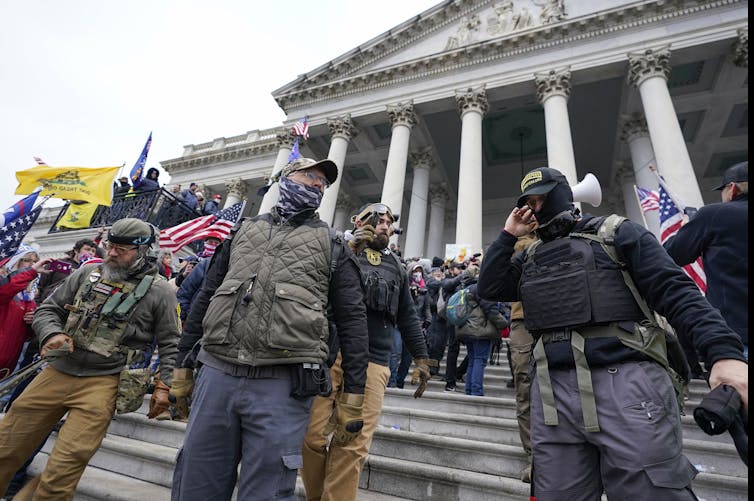
Members of the Oath Keepers stand at the east front of the U.S. Capitol on Jan. 6, 2021. AP Photo/Manuel Balce Ceneta

3. Many Oath Keepers are former military personnel

The Oath Keepers – who “may number in the thousands” – are a threat in part “because the Oath Keepers actively recruit current and retired members of the armed forces,” wrote Mia Bloom and Sophia Moskalenko, Georgia State University scholars of violent extremism.

They reported that “[a]bout 10% of the Oath Keepers are active-duty military, and around two-thirds are retired military or law enforcement,” and that “[s]everal Oath Keepers present at the Jan. 6 attack were veterans,” some of whom used a military formation to breach the Capitol.

In addition, a growing number of military personnel are involved in domestic terrorism, and an increasing number of extremists have military ties, Bloom and Moskalenko reported.

4. The First Amendment does not protect sedition

Those former military members may have taken an oath to protect the U.S. and its Constitution from all enemies, foreign and domestic, but they are finding that constitutional protections go only so far.

Far-right extremists or other hate groups can claim they are just venting or even fantasizing – both of which would be protected under the First Amendment,” wrote Amy Cooter, a scholar of extremism and militias at Middlebury’s Center on Terrorism, Extremism, and Counterterrorism. “For this reason, seditious conspiracy charges have historically been hard to prosecute.”

Cooter noted that Rhodes did not enter the Capitol on Jan. 6, 2021, but his conviction “suggests that the jury believed that Rhodes’ texts and other communications incited others to violent, undemocratic action in a way that requires accountability.”

Editor’s note: This story is a roundup of articles from The Conversation’s archives.The Conversation

Jeff Inglis, Freelance Editor, The Conversation

This article is republished from The Conversation under a Creative Commons license. Read the original article.